| Listing 1 - 7 of 7 |
Sort by
|
Periodical
ISSN: 23309172 Year: 1990 Publisher: Bethesda, Md. : American Congress on Surveying and Mapping
Abstract | Keywords | Export | Availability | Bookmark
 Loading...
Choose an application
- Reference Manager
- EndNote
- RefWorks (Direct export to RefWorks)
Cartography --- Geographic information systems --- Cartographie --- Systèmes d'information géographique --- Cartography. --- Geographic information systems. --- Cartografie. --- Geographical information systems --- GIS (Information systems) --- Cartography, Primitive --- Chartography --- Map-making --- Mapmaking --- Mapping (Cartography) --- Information storage and retrieval systems --- Mathematical geography --- Surveying --- Map projection --- Maps --- Geography
Book
ISBN: 3540527117 3642842178 3642842151 9783540527114 Year: 1990 Volume: 65 Publisher: Berlin New York Tokyo Springer
Abstract | Keywords | Export | Availability | Bookmark
 Loading...
Choose an application
- Reference Manager
- EndNote
- RefWorks (Direct export to RefWorks)
Navigation --- Cartography --- Digital mapping --- Data processing --- Congresses. --- Navigation, Primitive --- Locomotion --- Orientation --- Nautical astronomy --- Naval art and science --- Pilots and pilotage --- Cartography, Primitive --- Chartography --- Map-making --- Mapmaking --- Mapping (Cartography) --- Mathematical geography --- Surveying --- Map projection --- Maps --- Data processing&delete& --- Congresses --- Navigation - Data processing - Congresses. --- Cartography - Data processing - Congresses. --- Digital mapping - Congresses.

ISBN: 1282851497 9786612851490 0773562257 9780773562257 0773507280 9780773507289 Year: 1990 Publisher: Montreal ; Buffalo : McGill-Queen's University Press,
Abstract | Keywords | Export | Availability | Bookmark
 Loading...
Choose an application
- Reference Manager
- EndNote
- RefWorks (Direct export to RefWorks)
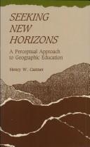
Castner developed this innovative perspective on geographic education through observation of the Orff-Schulwerk technique of music education. This pedagogical method provides an organizational framework within which the primitive elements and concepts of music can be introduced, experienced, and explored, and auditory discrimination developed. The process of improvisation is the focal point of the Schulwerk. Castner suggests that the numerous educational benefits of improvisation can be obtained in geographic education by the process of "mapping." He defines mapping as graphic description, analysis, and presentation in a problem-solving context. After more than two decades of research in cartographic communication, Castner concludes that success in examining and analysing landscapes, and images representative of them, is dependant upon developed skills in visual discrimination. Seeking New Horizons describes a rationale for linking basic visual discriminations to their logical extensions in the concepts that are fundamental to geographic thinking, thus providing challenging approaches to developing spatial awareness, graphic literacy, and geographic understanding. In addition, Castner identifies eight basic concepts which would allow students and teachers to work interactively with spatial information and, over time, with increasingly complex and sophisticated tools and at increasingly abstract levels of generalization.
Geography --- Visual perception. --- Cartography --- Cartography, Primitive --- Chartography --- Map-making --- Mapmaking --- Mapping (Cartography) --- Mathematical geography --- Surveying --- Map projection --- Maps --- Area studies --- Optics, Psychological --- Vision --- Perception --- Visual discrimination --- Study and teaching. --- Psychological aspects --- Geographical perception. --- Environmental perception --- Maps, Mental --- Mental maps --- Perceptual cartography --- Perceptual maps --- Orientation (Psychology) --- Space perception

ISBN: 0133509273 9780133509274 Year: 1990 Publisher: Englewood Cliffs (N.J.): Prentice Hall
Abstract | Keywords | Export | Availability | Bookmark
 Loading...
Choose an application
- Reference Manager
- EndNote
- RefWorks (Direct export to RefWorks)
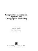
Artificial intelligence. Robotics. Simulation. Graphics --- Geographic information systems. --- Cartography --- Systèmes d'information géographique --- Cartographie --- Data processing. --- Informatique --- -Geographic information systems --- 681.3*H4 --- Geographical information systems --- GIS (Information systems) --- Information storage and retrieval systems --- Cartography, Primitive --- Chartography --- Map-making --- Mapmaking --- Mapping (Cartography) --- Mathematical geography --- Surveying --- Map projection --- Maps --- Data processing --- Information systems applications (GIS etc.) --- Geography --- Environmental Sciences and Forestry. Remote Sensing and Geographical Information Systems --- Geographical Information Systems --- Geographical Information Systems. --- 681.3*H4 Information systems applications (GIS etc.) --- Systèmes d'information géographique --- Geographic information systems --- Cartography - Data processing.
Book
ISBN: 3326002742 9783326002743 Year: 1990 Volume: 8 Publisher: Berlin Deutscher Verlag der Wissenschaften
Abstract | Keywords | Export | Availability | Bookmark
 Loading...
Choose an application
- Reference Manager
- EndNote
- RefWorks (Direct export to RefWorks)
Cartography --- History. --- 911.375 <09> <43> --- 912 <09> <43> --- 912 "14" --- 912 "15" --- -Cartography, Primitive --- Chartography --- Map-making --- Mapmaking --- Mapping (Cartography) --- Mathematical geography --- Surveying --- Map projection --- Maps --- Steden. Studie van stedelijke vestiging. Geografie van steden. Stadsgeografie--Geschiedenis van ...--Duitsland voor 1945 en na 1989 --- Cartografie. Kaarten. Plattegronden. Atlassen--Geschiedenis van ...--Duitsland voor 1945 en na 1989 --- Cartografie. Kaarten. Plattegronden. Atlassen--15e eeuw. Periode 1400-1499 --- Cartografie. Kaarten. Plattegronden. Atlassen--16e eeuw. Periode 1500-1599 --- History --- -Steden. Studie van stedelijke vestiging. Geografie van steden. Stadsgeografie--Geschiedenis van ...--Duitsland voor 1945 en na 1989 --- Cartography - Germany - Saxony - History. --- -History
Book
ISBN: 052883407X Year: 1990 Publisher: Chicago Rand McNally
Abstract | Keywords | Export | Availability | Bookmark
 Loading...
Choose an application
- Reference Manager
- EndNote
- RefWorks (Direct export to RefWorks)
Cartography
---
Early maps
---
Cartographie
---
Cartes anciennes
---
History
---
Facsimiles
---
Histoire
---
Fac-similés
---
America
---
Amérique
---
Discovery and exploration
---
Maps
---
Découverte et exploration
---
Cartes
---
Ouvrages avant 1800
---
912 "14"
---
912 "15"
---
912 <100>
---
910.4 <7>
---
980.02
---
-Discoveries in geography
---
-Explorers
---
-Voyages and travels
---
-Journeys
---
Travel books
---
Travels
---
Trips
---
Voyages and travels
---
Geography
---
Adventure and adventurers
---
Travel
---
Travelers
---
Discoverers
---
Navigators
---
Voyagers
---
Heroes
---
Discoveries in geography
---
Discoveries, Maritime
---
Exploration and discovery
---
Explorations in geography
---
Exploring expeditions
---
Geographical discoveries
---
Geographical discovery
---
Maritime discoveries
---
Explorers
---
Geographical discoveries in literature
---
Cartography, Primitive
---
Chartography
---
Map-making
---
Mapmaking
---
Mapping (Cartography)
---
Mathematical geography
---
Surveying
---
Map projection
---
Cartografie. Kaarten. Plattegronden. Atlassen--15e eeuw. Periode 1400-1499
---
Cartografie. Kaarten. Plattegronden. Atlassen--16e eeuw. Periode 1500-1599
---
Cartografie. Kaarten. Plattegronden. Atlassen--Wereld. Internationaal. Alle landen gezamenlijk
---
Ontdekkingsreizen. Reizen. Expedities. Reisverhalen--
Multi
ISBN: 9001962300 Year: 1990 Volume: 1 Publisher: Groningen Wolters-Noordhoff
Abstract | Keywords | Export | Availability | Bookmark
 Loading...
Choose an application
- Reference Manager
- EndNote
- RefWorks (Direct export to RefWorks)
History of the Netherlands --- anno 1800-1899 --- Cartography --- -Maps --- -Plans --- Cartographic materials --- Geography --- Cartography, Primitive --- Chartography --- Map-making --- Mapmaking --- Mapping (Cartography) --- Mathematical geography --- Surveying --- Map projection --- Maps --- History --- Facsimiles --- Netherlands --- Historical geography --- -Maps. --- Maps. --- -History --- The Netherlands --- Pays-Bas --- Países Baixos --- Holland --- Spanish Netherlands --- Pays-Bas espagnols --- Austrian Netherlands --- Pays-Bas autrichiens --- Oostenrijkse Nederlanden --- Southern Netherlands --- Pays-Bas méridionaux --- Zuidelijke Nederlanden --- Niderlandy --- Belanda --- Nederland --- Koninkrijk der Nederlanden --- Reino dos Países Baixos --- Royaume des Pays-Bas --- Kingdom of the Netherlands --- Países Bajos --- Holanda --- Nederlân --- Hulanda --- Beulanda --- Niderland --- Niderlande --- هولندا --- مملكة هولندا --- Mamlakat Hūlandā --- Olanda --- Payis-Bâs --- Países Baxos --- Aynacha Jach'a Markanaka --- Nirlan --- Niderland Krallığı --- Kē-tē-kok --- Landa --- Kerajaan Landa --- Нидерландтар --- Niderlandtar --- Нидерландтар Короллеге --- Niderlandtar Korollege --- Нідэрланды --- Каралеўства Нідэрланды --- Karaleŭstva Nidėrlandy --- Nederlands --- Niadaland --- Holandija --- Kraljevina Holandija --- Izelvroioù --- Нидерландия --- Niderlandii︠a︡ --- Кралство Нидерландия --- Kralstvo Niderlandii︠a︡ --- Països Baixos --- Нидерландсем --- Niderlandsem --- Нидерландсен Патшалăхĕ --- Niderlandsen Patshalăkhĕ --- Nizozemsko --- Paesi Bassi --- Regnu di i Paesi Bassi --- Iseldiroedd --- Nederlandene --- Niederlande --- Kéyah Wóyahgo Siʼánígíí --- Nižozemska --- Kralojstwo Nederlandow --- Madalmaad --- Ολλανδία --- Ollandia --- Hollandia --- Κάτω Χώρες --- Katō Chōres --- Βασίλειο των Κάτω Χωρών --- Vasileio tōn Katō Chōrōn --- Nederlando --- Reĝlando Nederlando --- Paisis Bajus --- Herbehereak --- Herbehereetako Erresumaren --- هلند --- Huland --- Niðurlond --- Háland --- Paîs Bas --- Neerlande --- Ísiltír --- Ríocht na hÍsiltíre --- Çheer Injil --- Çheer y Vagheragh --- Reeriaght ny Çheer Injil --- Tìrean Ìsle --- Hò-làn --- Недерлендин Нутг --- Nederlendin Nutg --- 네덜란드 --- Nedŏllandŭ --- Hōlani --- Nederlandia --- Pais Basse --- Regno del Paises Basse --- Нидерландтæ --- Niderlandtæ --- Нидерландты Къаролад --- Niderlandty Kʺarolad --- Konungsríkið Holland --- הולנד --- Holand --- ממלכת ארצות השפלה --- Mamlekhet Artsot ha-Shefelah --- Walanda --- Hollandi --- Нидерландла --- Niderlandla --- Нидерландланы Королевствосу --- Niderlandlany Korolevstvosu --- Néderlandzkô --- Нидерланд --- Iseldiryow --- Ubuholandi --- Ubuhorandi --- Nederilande --- Нидерланддар --- Niderlanddar --- Uholanzi --- Ufalme wa Nchi za Chini --- Нидерландъяс --- Niderlandʺi︠a︡s --- Нидерландъяс Корольув --- Niderlandʺi︠a︡s Korolʹuv --- Peyiba --- Holenda --- Keyatiya Nederlandan --- Payises Bashos --- פאייסיס באשוס --- Nīderlandeja --- Batavia --- Regni Nederlandiarum --- Nīderlandes Karaliste --- Nyderlandai --- Nyderlandų Karalystė --- Paixi Basci --- Paes Bass --- Ulanda --- Holland Királyság --- Keninkryk fan 'e Nederlannen --- Reino di Hulanda --- Холандија --- Кралство Холандија --- Kralstvo Holandija --- Pajjiżi l-Baxxi --- Hōrana --- Недерлатт --- Nederlatt --- Оцязорксши Недерлатт --- Ot︠s︡i︠a︡zorksshi Nederlatt --- Нидерландын Вант Улс --- Niderlandyn Vant Uls --- Tlanitlālpan --- Huēyitlahtohcāyōtl in Tlanitlālpan --- Eben Eyong --- Nederlaand --- オランダ --- Oranda --- オランダ王国 --- Oranda Ōkoku --- Ulanna --- Nethiland --- Nederlande --- Holandska --- Holland (Kingdom) --- Batavian Republic --- United Provinces of the Netherlands --- -Cartography, Primitive --- Plans
| Listing 1 - 7 of 7 |
Sort by
|

 Search
 Feedback
 About
About Help
Help News
News